REVIEW · ROME
Rome: Mini hike to the ancient Parco degli Acquedotti
Book on GetYourGuide →Operated by Hike with Nature of Sal · Bookable on GetYourGuide
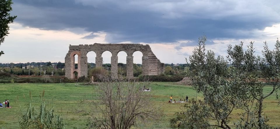
Aqueducts meet city streets. This 3-hour hike threads from Pigneto into the Parco degli Acquedotti, where Roman stonework runs alongside real plants, birds, and uneven paths. It’s a great way to see Rome past the usual postcard stops.
I love the contrast: start in everyday neighborhoods, then slowly step into a quieter zone where ancient arches stretch into the distance. I also love how guide Sal turns aqueduct engineering into something you can spot while you walk—materials, function, and how the area got used over time.
The only real catch is that it’s a one-way hike over about 9 km on uneven terrain, and it runs rain or shine. Plan how you’ll get back from the finish point, and wear proper shoes.
In This Review
- Key points before you go
- Starting Outside Pigneto: the walk begins in real Rome, not a ticket line
- Mandrione Parks and Porta Furba: neighborhood Rome plus a big historical hinge
- The aqueduct lesson you can actually see: engineering made walkable
- The local café stop: break time that doesn’t break the vibe
- Torre Fiscale Park to Parco degli Acquedotti: where city sounds fade
- Why this aqueduct park feels different from Rome’s big sights
- Difficulty, distance, and footwear: what moderate really means on this route
- What to bring so the hike feels good, not just doable
- Small group pacing: why max 10 participants matters on a hike like this
- Price and value: is $53 worth a 3-hour aqueduct hike?
- Who should book this hike (and who should skip it)
- Final recommendation: should you book the Parco degli Acquedotti mini hike?
- FAQ
- Where does the hike start?
- Where does the hike end?
- How long is the hike?
- What’s the difficulty level and distance?
- What language is the guide?
- What should I bring?
- Does it run in bad weather?
Key points before you go
- Pigneto to Parco degli Acquedotti, one-way and efficient: the route is designed so you don’t backtrack.
- Aqueducts + nature in the same frame: you’ll keep seeing stonework alongside greenery as the trail changes.
- Sal’s engineering-and-life explanations: you get more than dates—you learn how it worked and why it mattered.
- Small group (max 10): easier pace, more chances to ask questions.
- Moderate 9 km with uneven ground: manageable for fit walkers, but not for flip-flops or sandals.
- Heat-smart guidance: water breaks and shade matter on hot days.
Starting Outside Pigneto: the walk begins in real Rome, not a ticket line
You meet right outside the subway station Pigneto (C-Line), with a clear orientation point: two exits, and the meeting side is by the Conad side. You’ll want to arrive about 15 minutes early so the group can get moving and avoid delays.
Before you even reach the park, this start matters. Pigneto has that lived-in, working-city feel, so the hike doesn’t start in a museum bubble. You follow the aqueduct route from the street level, where you can still sense how Rome layers old infrastructure onto modern life.
You’ll walk along Via del Pigneto with a guided orientation. Expect short stops where the guide connects what you’re seeing—walls, lines, elevations—to how aqueduct systems needed steady planning.
You can also read our reviews of more hiking tours in Rome

Mandrione Parks and Porta Furba: neighborhood Rome plus a big historical hinge
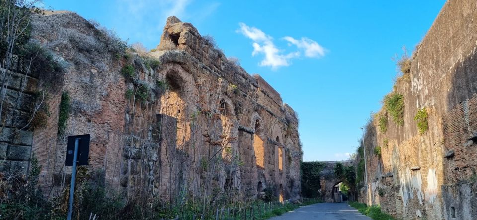
After the first stretch, you’ll pass through Parchetto Condiviso del Mandrione, a small park area that helps shift the mood. It’s not “wild” yet, but it gives you space to notice the environment—plants, shade patterns, and the kind of ground that will make walking easier or harder later.
Then you continue along Via del Mandrione, moving deeper into the corridor that guides the hike toward the aqueduct zone. This part is useful because it shows Rome’s in-between spaces: not the center, not the countryside, but a working geography where nature and human construction coexist.
One of the turning points is Porta Furba (or Arco di Sisto V). Even if you only know Rome for grand monuments, this stop reframes the story. Instead of a single famous site, you get a sense of how gates, routes, and water systems shaped movement and settlement.
The aqueduct lesson you can actually see: engineering made walkable
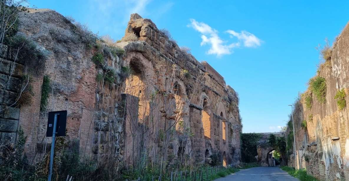
This hike is built around one simple idea: aqueduct history sticks when it’s connected to what’s physically in front of you. As you follow the aqueduct’s presence, you learn not just what it was for, but how the Romans got it done.
You’ll hear details about the materials used to build aqueducts and how the system supported daily life. The guide also brings in wider connections—there’s talk tying engineering to nature and how people used and adapted the area over time.
One reason this works so well is pace. You’re not sprinting from one viewpoint to the next; you’re walking at a speed that lets the guide point out small features. That’s how it turns into a real learning experience without feeling like a lecture.
And yes, it’s also a strong photo route. The aqueduct perspective—especially where arches and long lines stretch—gives you those “how is this still here?” angles that photographers love.
The local café stop: break time that doesn’t break the vibe
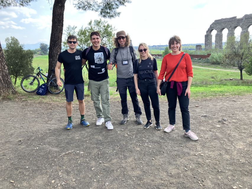
About mid-tour, you’ll hit a local café for a break. This is practical planning, not a random detour. It’s your moment to refuel, sip something, and reset your legs before the final push into the bigger park area.
If you’re hiking in warmer months, this break timing is smart. The guide is careful about shade and water breaks, so you’re not just marching until you feel terrible. On a hot afternoon, that makes a noticeable difference in comfort.
Bring your own water plan too. The hike guidance calls for 1.5 liters of water, and that’s a good number if you want the freedom to keep pace without worrying.
Torre Fiscale Park to Parco degli Acquedotti: where city sounds fade
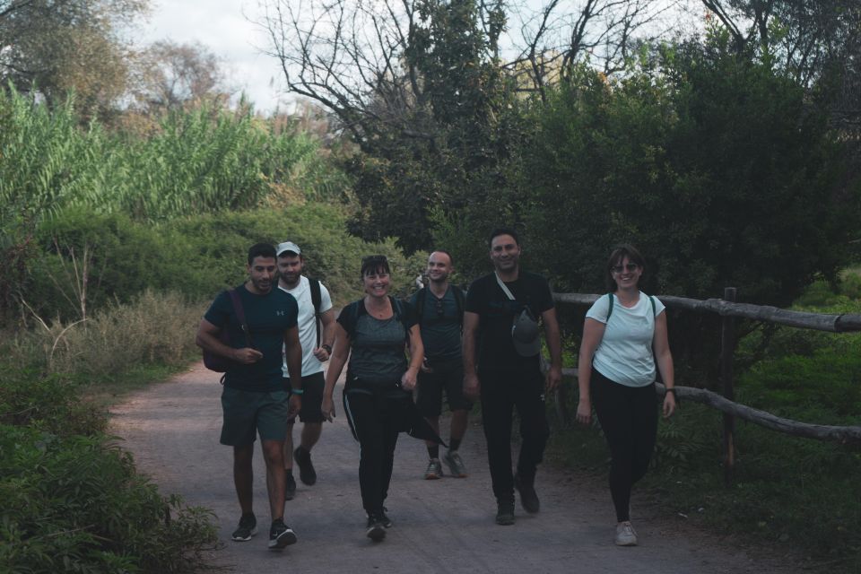
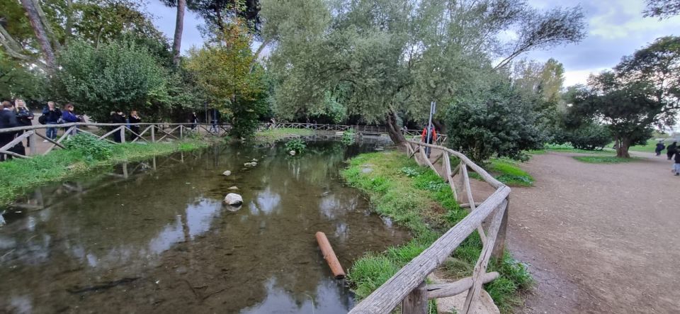
As you move from the earlier street-and-park segments toward Torre Fiscale Park, the hike starts to feel more like a real escape. The surroundings shift—more room for plants, more open walking paths, and fewer interruptions from traffic.
This is also where the “surreal mix” becomes obvious. You’re looking at ancient structures and natural space at the same time. The aqueduct lines guide your attention, while the greenery softens the whole scene.
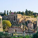
Then comes the payoff: Parco degli Acquedotti. This is the heart of the experience, and it’s exactly what you want from an “ancient park” hike—stonework in the open air, with nature doing what it does around old infrastructure.
On good weather days, you can even catch a mountain backdrop in the distance. It won’t be guaranteed every day, but it’s a nice extra when the skies cooperate.



Why this aqueduct park feels different from Rome’s big sights
Rome’s famous ruins often feel like they’re “over there,” separated from your daily world. Here, the aqueducts sit inside a space that still feels alive. That’s the whole point of hiking this route instead of just sightseeing it from one spot.
You’ll notice how humans built for long-range function, while nature kept returning in and around the structures. That interplay is what makes the experience feel more modern than ancient—because you’re seeing the system as a living corridor, not just a dead relic.
You’ll also pick up environmental connections as you go. The guide pays attention to fauna and flora, so the park becomes a lesson in how water engineering changes the environment around it.
This isn’t about romanticizing ruins. It’s about understanding why this worked—how water was transported, how it supported settlement, and how the built environment and the natural one keep shaping each other.
Difficulty, distance, and footwear: what moderate really means on this route
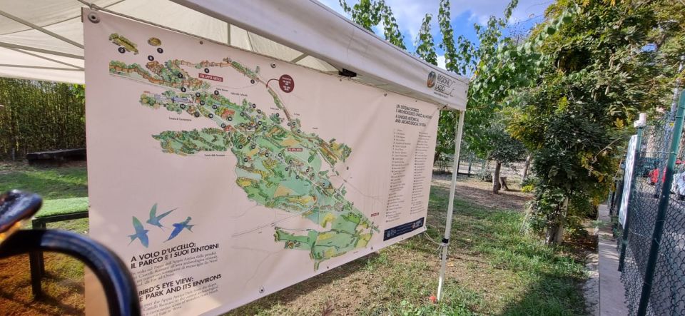
The hike is rated moderate, and the numbers are important: about 9 km / 5.5 miles with uneven terrain. Moderate here means you’ll be walking continuously, and you’ll need to manage your footing. It’s not the type of trail where you can coast in sneakers with worn soles.
Footwear is non-negotiable. The guidance is clear: comfortable walking shoes, and sandals or flip-flops aren’t allowed. If you’ve got hiking shoes, bring them—especially on days after rain, when surfaces can get slick.
You’ll also want to keep your expectations realistic about the one-way route. It starts near Pigneto and finishes close to Giulio Agricola (A-Line). That’s convenient, but it also means you should plan your transport back to wherever you’re staying.
Terrain aside, weather is the other major factor. This activity happens rain or shine, and the final duration and route can adjust for obstacles like fallen trees or safety reasons. If you want an always-the-same itinerary experience, this isn’t that.
What to bring so the hike feels good, not just doable
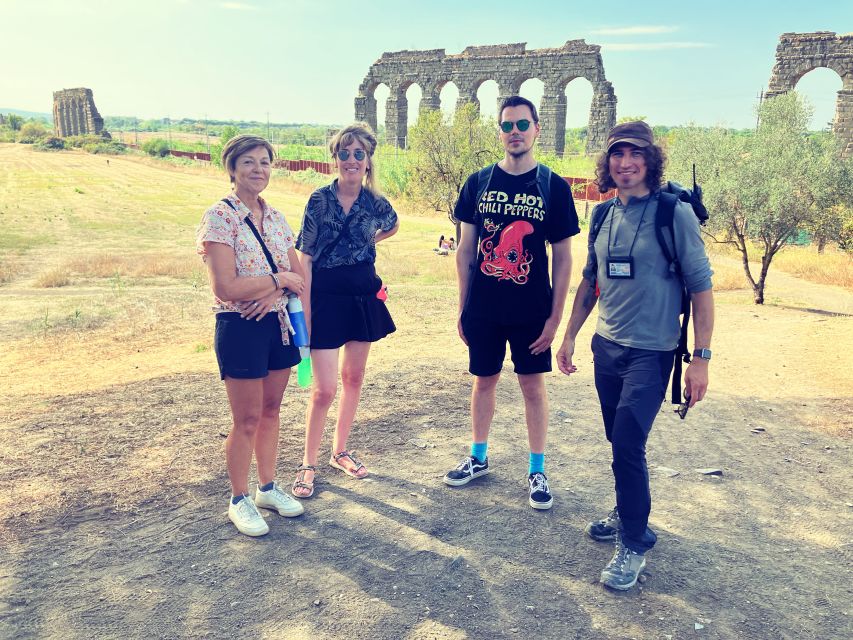
Here’s your quick packing list based on what the hike calls for:
- 1.5 liters of water (obligatory)
- Comfortable shoes for uneven ground (obligatory)
- Rain layer and sun protection (recommended: raincoat, sunscreen, hat)
- A small backpack if you need a place for snacks and layers
- Trail snacks if you like having something between stops
Optional add-ons that can improve comfort: hiking poles and electrolytes if you tend to cramp or sweat a lot.
If you’re traveling light, at least don’t skip water and shoes. Everything else is about comfort, but water and traction keep you moving safely.
Small group pacing: why max 10 participants matters on a hike like this
This hike keeps the group small—limited to 10 participants. That sounds like a minor detail, but on a moderate route it changes the experience. You get fewer bottlenecks at stops, and the guide can actually adjust pace to the group’s energy.
It also helps with learning. When a guide can see faces and hear questions, explanations land better. This is one of those tours where conversational context matters, especially when you’re connecting engineering to what you see in front of you.
The guide’s style also comes through in how people describe it: easy to talk with, attentive to comfort, and good at linking nature, history, and practical details without making it feel like a textbook.
Price and value: is $53 worth a 3-hour aqueduct hike?
At $53 per person for about 3 hours, the value depends on what you want from Rome. If your goal is a quick photo stop, you can probably find cheaper options on your own. But if you want an actual guided walk that turns ruins into a coherent story, the price makes sense.
Here’s why it feels worth it:
- A professional guide who explains both the structure and the setting
- A guided experience in English or German
- The route covers real Rome: neighborhoods, gates, park segments, and the aqueduct park end
- A small group size, which usually means less waiting and better attention
If you’re a solo traveler who prefers not to navigate logistics of route direction and pacing, guided also saves mental energy. And since the hike ends near a subway line, you’re not stranded when you finish.
Who should book this hike (and who should skip it)
This works best for walkers who enjoy a mix of city neighborhoods and outdoor time. If you like nature and you don’t mind uneven ground, you’ll probably find the experience satisfying and different from the usual Rome checklist.
It also seems family-friendly, but with clear age limits. Children must be 14+ and accompanied by adults. Also, it’s listed as not suitable for people under 12, and it’s not suitable for wheelchair users.
Skip it if you have medical constraints like heart problems or respiratory issues, or if you’re in a higher age range listed as not suitable. (In cases like this, it’s better to choose a gentler option you can enjoy without pressure.)
Final recommendation: should you book the Parco degli Acquedotti mini hike?
Book it if you want a Rome experience that mixes history you can see with nature you can walk through, and you like the idea of starting in a real neighborhood like Pigneto. The aqueduct park ending is the payoff, but the route itself is part of the value—especially if you enjoy photography, walking, and explanations that connect engineering to everyday life.
Skip it if you’re seeking an easy, flat, short stroll. Moderate distance, uneven terrain, and rain-or-shine mean you’ll want the right shoes, the right attitude, and a plan for getting home from the one-way finish.
If you fit the walking profile, this is one of the better ways to get an honest sense of how Rome’s built world and natural world share the same space.
FAQ
Where does the hike start?
It starts right outside the subway station Pigneto (C-Line). You should meet at the exit side next to the Conad grocery store.
Where does the hike end?
The hike finishes close to the subway station Giulio Agricola (A-Line), with the end point listed at Via Lemonia, 214, Rome.
How long is the hike?
The duration is about 3 hours.
What’s the difficulty level and distance?
It’s rated moderate, with a distance of about 9 kilometers (5.5 miles) and includes uneven terrain.
What language is the guide?
The live guide runs in English and German (and the experience notes also mention Italian among included languages).
What should I bring?
You should bring comfortable walking shoes and 1.5 liters of water. A raincoat, sunscreen, and a hat are recommended, and trail snacks are optional.
Does it run in bad weather?
Yes. The hike takes place rain or shine, and the route or duration may be adjusted for safety reasons or unexpected obstacles.